
Dozens of sites across northern Australia have been subjected to major flooding over the past couple of days, with some river levels still increasing after parts of Queensland recorded their highest three-day rainfall totals between Sunday and Tuesday.
The map below shows the status for the more than 90 monitoring stations (many of them at different points along the same rivers) across New South Wales, the Northern Territory and Queensland showing either a minor, moderate or major flood as of Thursday morning.
The levels at more than half of these stations were either still rising or steady, but authorities have warned some rivers may not have peaked yet.
Sign up: AU Breaking News email
The Bureau of Meteorology defines major flooding as an event that results in extensive inundation, likely isolation of properties and towns and potential evacuation by people from affected areas.
Guardian Australia identified at least 50 river monitoring stations across Queensland and the NT that breached the “major flooding” threshold since 5 March. Even more sites have seen significantly elevated river heights but do not have published flooding thresholds.
But these warnings are just a point in time – if we zoom in on a couple of sites we can see how water levels surged after the huge rain dumps on 6 and 7 March in the NT and on 9 and 10 March in Queensland.
The chart below shows the river heights compared to flooding thresholds for the Katherine River at Katherine Bridge and the Daly River at Daly River Police Station in the NT, and the Burnett River at Bundaberg in Queensland.
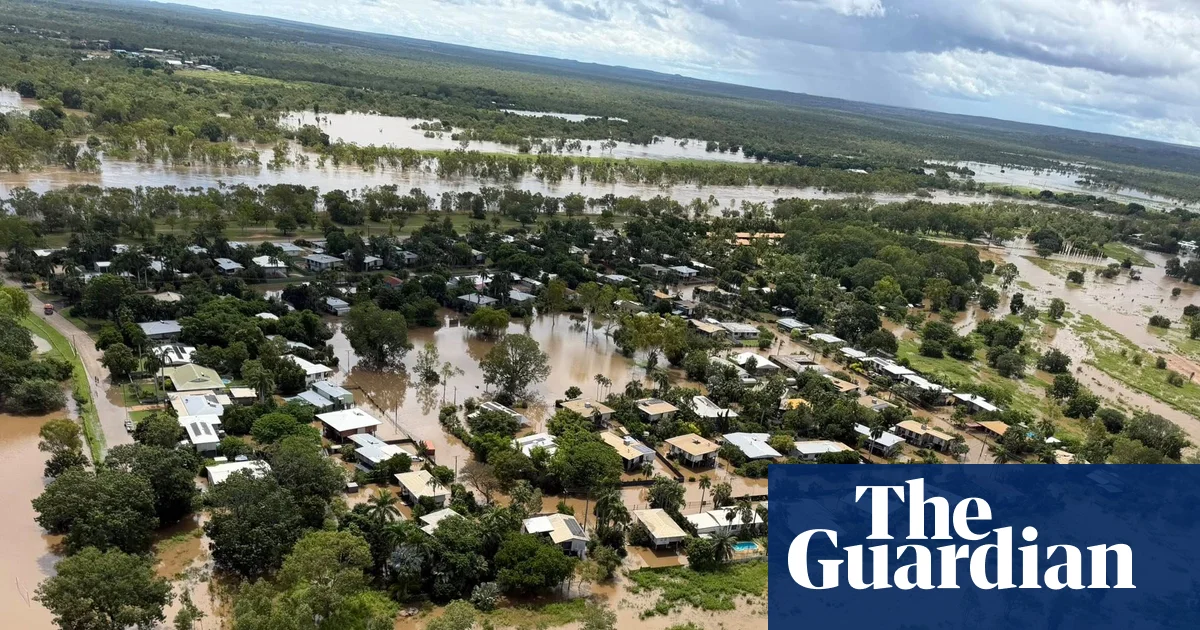
Katherine has experienced its worst flooding in decades, with residents warned to stay out of flood waters due to the risk of wastewater overflows and crocodiles. Hundreds of residents near the Daly River were airlifted over the weekend, mostly to Darwin. The BoM said on Wednesday afternoon that the Daly River was “likely to remain above the major flood level for at least the next week”. Hundreds of homes and businesses have also been inundated in Bundaberg, after the Burnett River burst its banks in the wake of a tropical low.
The flooding comes after hundreds of millimetres of rain over the past week – Tipperary in the NT was one of several sites that recorded more than 100mm of rain on consecutive days.
The map below shows the daily rainfall since 6 March. Measurements are usually taken at 9am and show the rain over the previous 24 hours. It shows the torrential rain first hitting parts of the Northern Territory over the weekend, with Queensland bearing the brunt over Monday and Tuesday.
Across Australia, the 2025-26 summer was the wettest in nearly a decade, according to the BoM, with rainfall 32% higher than average across the country.
Preliminary data suggested Darwin’s wet season would be the seventh wettest on record, according to Daniel Hayes of the BoM. Katherine is on track for its fifth wettest ever wet season.
