
A dangerous swell has forced the suspension of some ferries across Sydney harbour, the latest in a spate of wild weather that has brought snowfall, power outages and storms to the country’s south-east.
Surf Life Saving NSW is warning the highest waves may surge close to 15 metres during the next 24 to 48 hours, which could be the biggest in 100 years, as dangerous swells and strong winds create deadly conditions.
Ch Insp Anthony Brazzill from Marine Area Command said swells were expected to be unpredictable this weekend and would put anyone entering the water at risk, even those with lifejackets.
“We’re urging anyone who planned to head out on the water this weekend to reconsider it,” Brazzill said.
“Strong winds and powerful surf are expected, which will put not only the public at risk but also emergency services.”
While the NSW police force have high performance resources, the severe weather will severely limit the ability to conduct search and rescue in some instances, he said.
“The message is clear. Monitor the weather closely and try to stay away from the water this weekend. Our top priority is your safety,” Brazzill said.
The storms will also bring strong winds, with Sydney expected to experience gusts of above 100km/h on Friday evening, with Illawarra expecting gusts of 120-130km/h.
There are expected to be delays at Sydney airport on Friday evening and several ferry services over the weekend. The F1 Manly Ferry service, which runs between the Northern Beaches and Circular Quay, was cancelled on Friday afternoon due to the forecast.
While many storm watchers kept their eyes on the west and the path of Tropical Cyclone Narelle, Australia’s east coast was slammed on Thursday night.
Tens of thousands of people in New South Wales lost power late Thursday, with about 4,000 homes still in the dark on Friday morning.
A severe storm swept across the state, causing chaos for commuters, with trains and metro services cancelled on Sydney’s north shore.
The State Emergency Service recorded 400 incidents statewide, including 46 in Dubbo which was badly affected by severe thunderstorms.
Severe winds partially collapsed a crane on a building site in the central west NSW city, with footage on social media showing a crane operator escaping just in time.
Allow Facebook content?
This article includes content provided by Facebook. We ask for your permission before anything is loaded, as they may be using cookies and other technologies. To view this content, click ‘Allow and continue’.
Emergency crews responded to multiple reports of fallen trees that damaged cars and tangled power lines.
The storm caused chaos for commuters, with trains and metro services cancelled on Sydney’s north shore.
Fans at Brookvale Oval were forced to take cover before the NRL game between the Manly Sea Eagles and Sydney Roosters as the ground was inundated with rain.
Meanwhile the temperature dropped below zero in parts of NSW’s central and southern tablelands and the Snowy Mountains on Friday, while many in the country’s south-east felt the chill of single-digit temperatures.
In Orange, in NSW’s central west, it was just 2C overnight with residents there and in nearby Millthorpe waking up to snowfall. On Thursday, the mercury reached 26C at Orange airport.
In Oberon, in the central tablelands, the temperature dropped to 3C overnight, with a maximum of 9C forecast for the rest of Friday.
The wintry conditions follow a sultry summer during which more than 60 weather stations across the nation recorded their highest daily maximum temperatures yet, and overall Australia had its fifth-warmest summertime night temperatures on record.
Wind gusts above 100km/h were forecast for Friday for many southern coastal areas in NSW as the vigorous coastal low continued to impact large swathes of the state.
In Victoria, wild and windy conditions persisted into Friday morning, with southerly wind gusts of about 90km/h recorded in Melbourne.
Thursday sport was also affected, with most of the first day of the Sheffield Shield final washed out and Geelong’s home AFL game against Adelaide hit by the wet conditions.
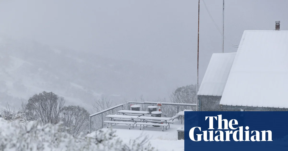
Alpine areas experienced their first snowstorms of the year, with the Bureau of Meteorology forecasting blizzard conditions for areas above 1,600 metres on Friday, and snow falling at Thredbo, Falls Creek and Hotham.
Ten centimetres of snow fell overnight at Perisher, Australia’s largest ski resort, with 15cm at Thredbo.
Parts of NSW and the Australian Capital Territory could experience their coolest March day in more than 30 years, the bureau said.
Destructive winds are likely along much of the coastline before easing across the weekend.
The BoM has forecast a high of 23C in Sydney on Saturday and 25C on Sunday, with a high of 19C in Melbourne on Saturday and 20C on Sunday.
